2013 Grand Canyon Trip

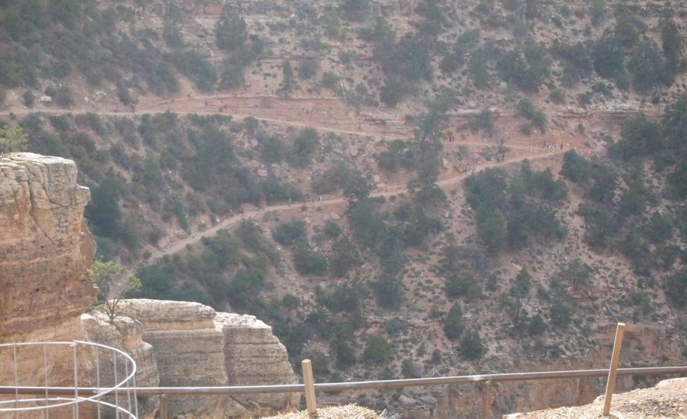
Hiking Down to the First Tunnel on Bright Angel Trail
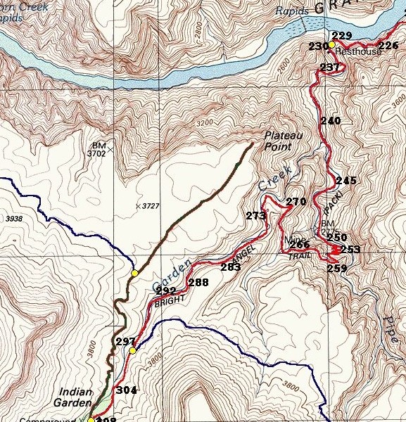
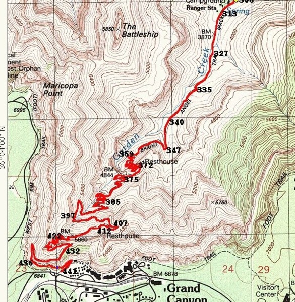
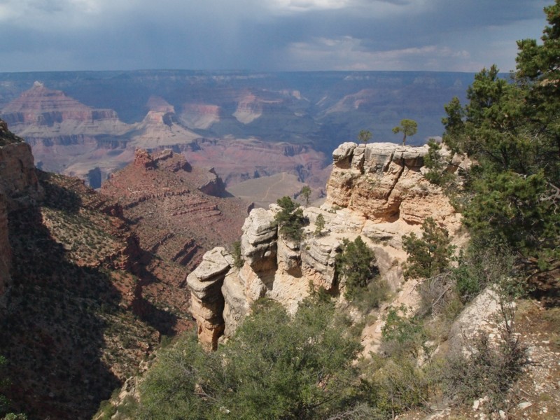
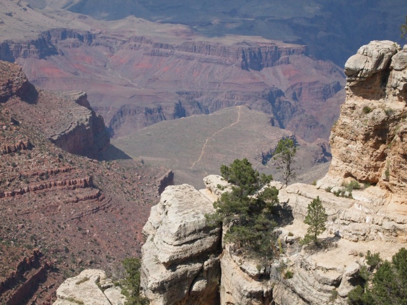
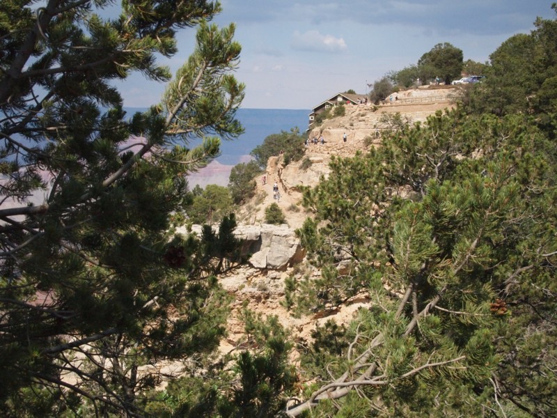
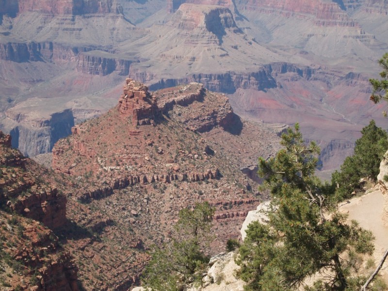
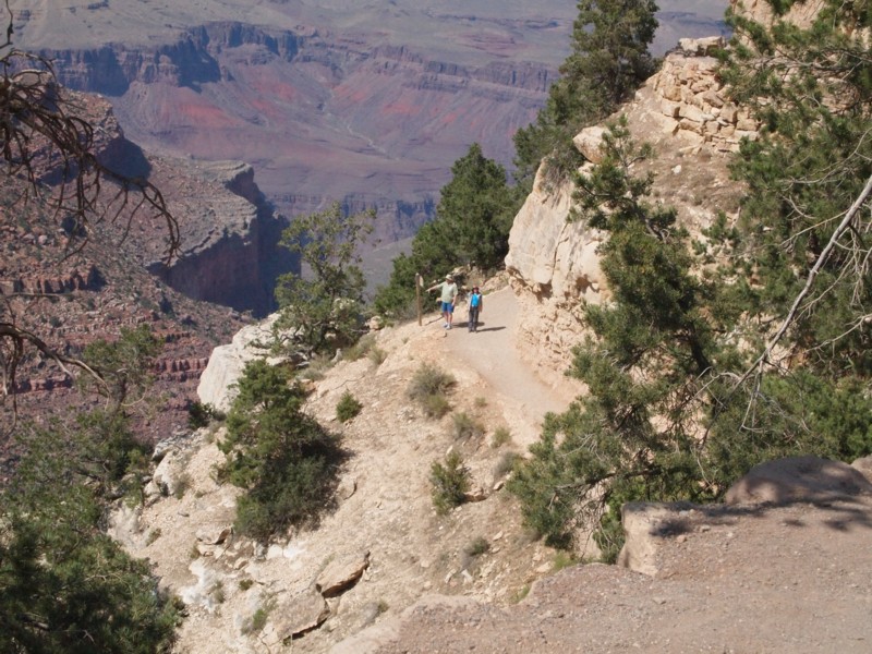
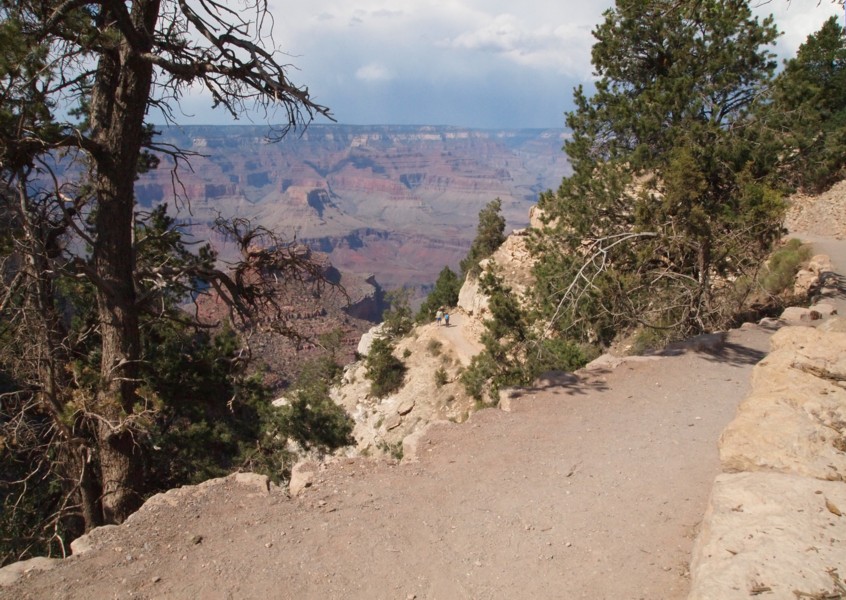
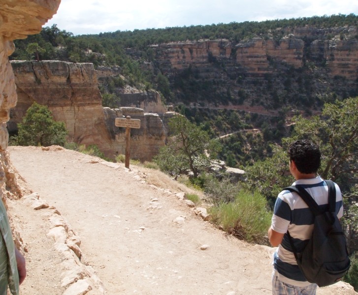
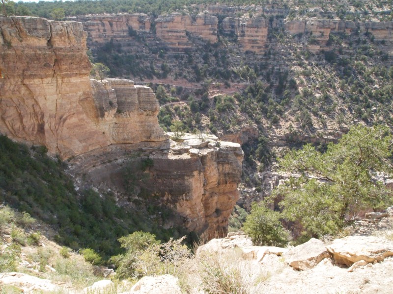
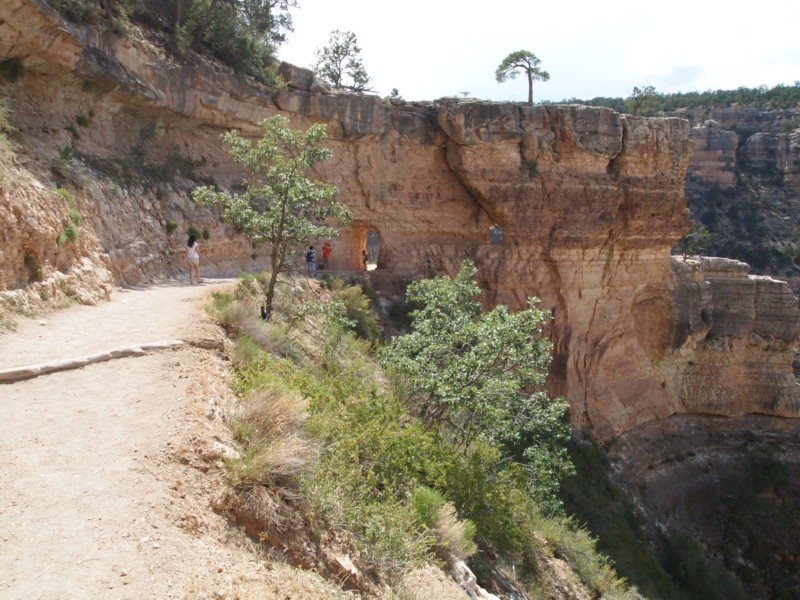
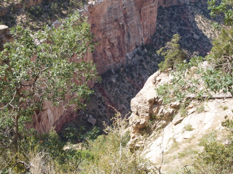
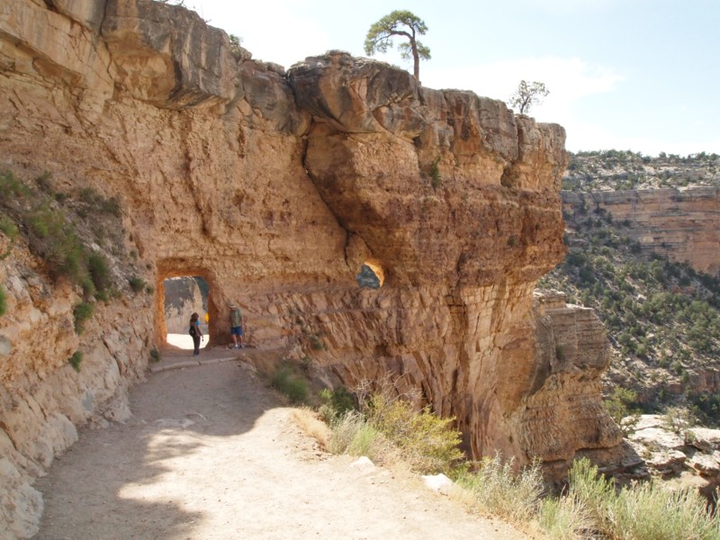
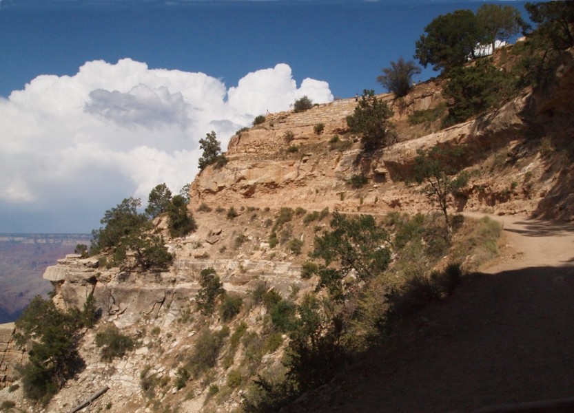
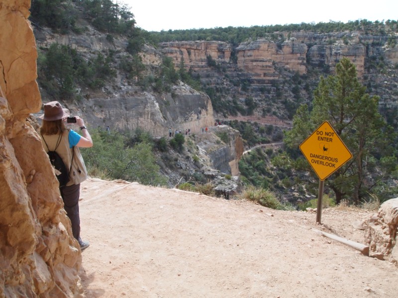
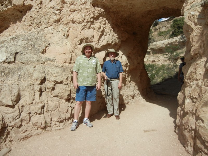
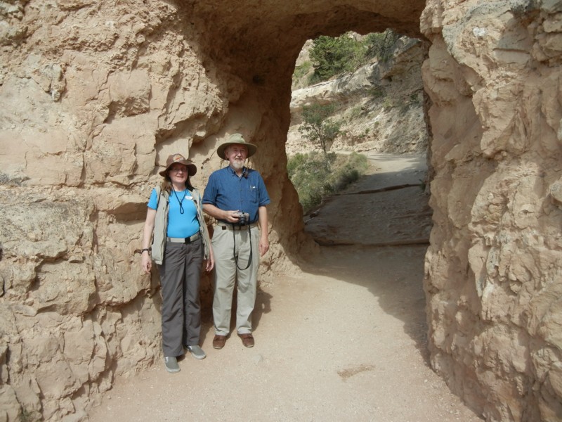
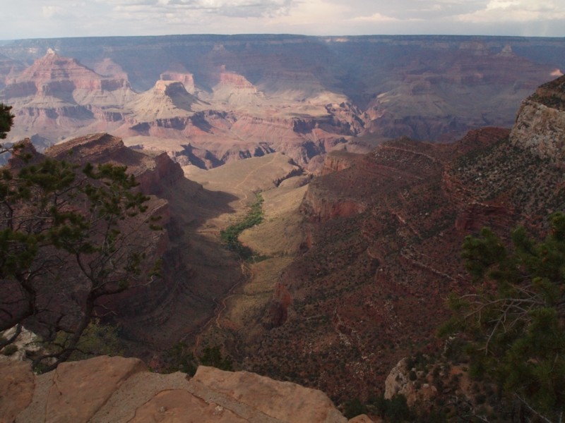
Switchback Trail
WIDTH=100% HEIGHT=100%>

Hiking the Bright Angel Trail is one of the big adventures of the Grand Canyon. It is about 7.7 miles from rim to river with a drop of 4,460 feet. There are warning signs in several places explaining why a one-day hike to the river and back is something that even the physically fit should not attempt. Assuming a 3 mph hiking speed down hill, it would take two and a half hours to reach the river. Everyone seems to agree that It takes twice as long to hike uphill as it takes downhill, so the total hiking time, assuming one can actually hike that long, would be seven and a half hours. Add in some rest stops and the total trip could be 12 hours. That's something that would have to begin early and finish late. Even the branch off to Plateau Point is 6.6 miles (from the rim), but there's less of a climb back across the plateau.

Since our schedule started late the first day and had to end early on the next, I suggested that we make a quick hike down to the first tunnel on the trail and then back to the rim. After that we could decide whether we wanted to hike down for 20 or 30 minutes and then return. It turns out that the short hike satisfied us.

USGS Maps

Lower Trail
Upper Trail


Trail Tunnel

The two pines, one small and one large, provided a good landmark. The Bright Angel Trail goes through a tunnel at the base of this point. The tunnel is directly below the larger tree. The trail exits the tunnel and follows the cliff in a direction toward the viewer. A distinctive peak, shown more clearly in a later photo, is on the left center of this photo.

Plateau Point Trail

The branch of the trail that splits off and crosses to Plateau Point is visible from many points along the rim trails. In this telephoto view, the small pine is just visible on the upper right; the peak is out of the view on the left.

Ridge, River, and Dome

The Bright Angel Trail starts up at the parking lot. I took this photo and then we walked on up to the start of the trail. I asked Louis and Becky to go on down to the corner where these folks are so I could take their picture, and then I would follow.

A Distinctive Geological Feature

In the meantime I took a photo of this peak; one of the prominent features of the landscape.

Sign on Trail.

Louis and Becky weren't sure which corner I referred to - things do look very different as you walk from one place to the other - so they were waiting somewhere where we couldn't see each other. Finally they came on down to this sign which is just barely visible in the previous photo of the trail.

Wide View of Trail Beginning

This wider angle photo puts the trail area in perspective. After I took these photos, I hurried down and walked along with them to the tunnel.

The Trail toward the Switchback

This is the view of the trail beyond the sign. The small and large pines are almost lost in the greenery on the left. The switchback in the trail is visible far down the cliff in the distance.

Switchback Trail

The switchback in a telephoto view. The 'pine tree' point extends into the center of the photo.

The tunnel

This a nice view of the walk through the tunnel with the two pine trees on the top of the point and the window below the big pine. It's interesting that in the first photo the pine appeared to be over the tunnel, but here it appears to be over the window.

Chasm below Trail

This is the view below the trail.

Becky and Louis in the Tunnel

Becky and Louis pause at the tunnel.

View Back Up the Trail

A look back up the trail.

Becky

Becky photographs the view of the trail switchback.

Louis and Jim at Tunnel

We went on through the tunnel to the sunny side for these photos and then turned back.

Becky with Jim at the Tunnel

Trail to Plateau Point

We followed the rim trail east along the Grand Canyon Village area and I got this late afternoon view of the branch of the trail that goes out to Plateau Point. The trails separate at the campground shown on the maps; the left, to the Plateau Point where it ends and the right, where Bright Angel Trail goes on through the crevice and down to the river.

LINKS TO GRAND CANYON TRIP PAGES

Page 1 - Amtrak Train - Houston to El Paso - Houston Amtrak station, Amtrak train, Alpine photos, and others.
Page 2 - Travel - El Paso to L.A. to El Paso - Photos from the stops at El Paso and Tucson with other views along the way to L.A.
Page 3 - Union Station Area - Photos of Union Station and neighborhood.
Page 4 - Williams, Arizona - The town of Williams, Arizona, claims that it was the last town on old U.S. Route 66 to be bypassed by Interstate Highway 40. It is the railroad gateway to Grand Canyon Nation Park.
Page 5 - Train to El Paso - (PAGE NOT COMPLETE) Hos.
Page 6 - Bright Angel Trail - The Bright Angel Trail is one of the big adventures of the Grand Canyon. It is about 7.7 miles from rim to river with a drop of 4,460 feet. We didn't hike that far, but we got several nice photos.
Page 7 - Train to El Paso - (PAGE NOT COMPLETE) .
Page 8 - Hiking the Rim Trail - Louis and I hiked from Hermit's Rest to Powell Point.
Page 9 - Hiking the Rim Trail - Louis, Becky, and I hiked from the Abyss to Mohave Point.


Skipper Family Magazine
INDEX PAGE


Posted: 7/30/13
E-mail me: jamesmskipper1141@att.net