|
|---|
|
|
|---|
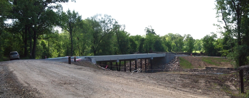
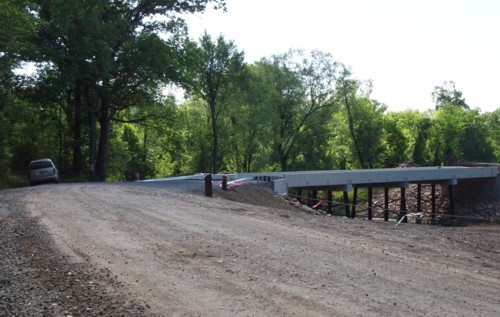
In 2011 a large truck attempted to cross the old 1891 Fryer Bridge. The high load caught the superstructure of the bridge which cause the north end of the bridge to fall into East Point Remove Creek. The truck didn't fall into the creek. The following views show the new bridge built the following year. Some of the views were taken from the same viewpoints of the corresponding views of the old bridge shown on another page.
|
|---|
| This view from the north bank upstream of the new bridge is approximately the location from which I photographed the old bridge shown on this page. |
|
|---|
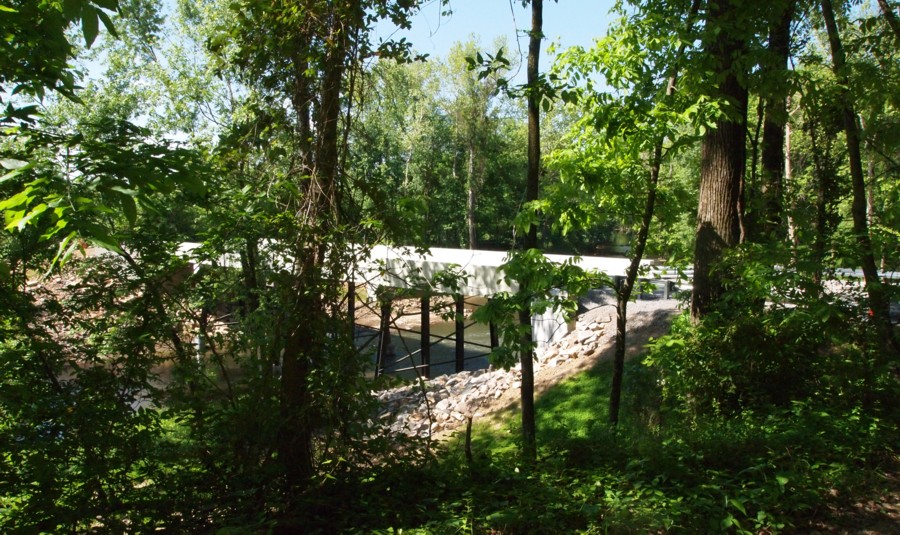
| This view of the north approach to the new bridge is approximately the location from which I photographed the old bridge shown on this page. |
 |
 |
|---|---|
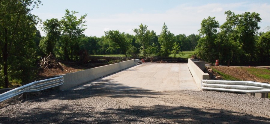
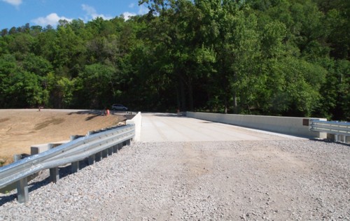
| The view upstream from the new bridge. | The view downstream from the north approach to the bridge. That area just below the bridge looks like it could serve as a 'ford' or low water crossing. They had to cross a ford at the crossing north of Solgohachia even after T-Models were delivering the mail. A place like this would be easy for a horse and rider and even a team with a wagon as long as the bottom wasn't too muddy and the water too high. In the old days, travelers would inquire of residents in the area for guidance on the safety of the water level. |
 |
 |
|---|---|
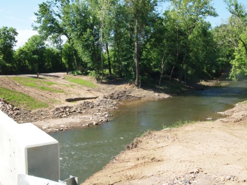
| The view from back up the road on the north bank. | The view from the south side of the bridge. |
|
|---|
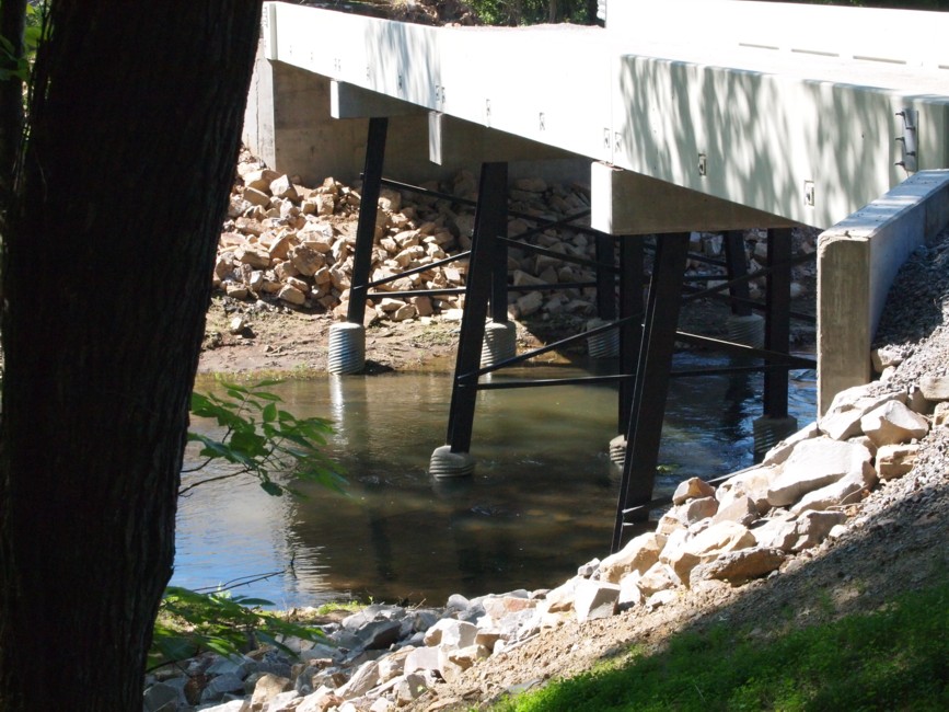
| Brige supports. |
 |
|---|
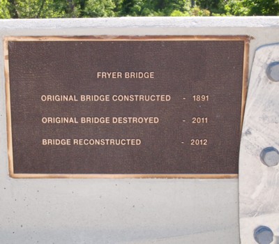
| A nice plaque was placed on the bridge. |
 |
|---|
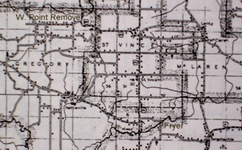
| This is a portion of the Conway County Road map of 1936. Solgohachia is in the lower right corner. Fryer Bridge is near the top corner of the 'F' in Fryer. Old Hickory isn't listed but it is near the 'G' in Gregory Township on the left. Hattieville is to the southeast of Old Hickory. The new Wonderview High School was built at the top center on the north ridge of Pigeon Roost Mountain just above the 'c' in St. Vincent. The bridge in a later photo is located where the road crosses the creek near the 'e' in W. Point Remove. |
| Fryer Bridge - Several photos of the bridge. |
| Fryer Bridge - LOST - These photos show were the bridge used to be and the remains of the bridge in the creek. |
| The New Fryer Bridge - These photos show the new bridge over East Point Remove Creek at the Fryer Bluff Crossing. |
| Fryer Bluff - Several photos of the bluff and photos of some other old bridges. |
| Ouachita River Crossings - Photos of Ouachita River crossings from its headwaters north of Mena to Arkadelphia. |
| Illinois Bayou Bridge - Photos of the Illinois Bayou and the one-lane bridges north of Scottsville, Arkansas. |
| Maxine Payne-Caufield - The Web Site of the young woman who did the photo essay referenced on this page. I highly recommend the site of this 'okra' girl. |
| Bridge Hunter - An excellent site for data on old bridges. This is the Fryer Bridge page with 21 photos of the bridge at various seasons and includes a name plate at the top of the structure that I couldn't get to to photograph. There is a map and a big table of bridge facts with dimension and so forth. There is data on the most recent inspection. The bridge is woefully deficient. |
|
Skipper Family Magazine INDEX PAGE and Guestbook |
 Powered By Ringsurf |
|---|
|
Add Free Stats |
|---|
Posted 7/1/05